
How Does Technology Help Monitor Volcanic Eruptions?
Gusti Ayu Tita P
19 September 2026
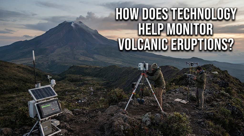
Volcanic eruptions can change quickly, so monitoring volcanoes is important for reducing risks to people and communities. Modern technology allows scientists to observe changes in volcanic activity more accurately and continuously. Instruments can detect earthquakes, ground movement, volcanic gases, and temperature changes around a volcano. The information collected can help authorities make decisions about volcanic hazards and evacuation.
SEISMIC SENSORS DETECT VOLCANIC EARTHQUAKES
Seismic sensors are important tools for monitoring volcanic activity. They detect vibrations and earthquakes caused by the movement of magma beneath a volcano. An increase in volcanic earthquakes can indicate that the volcanic system is changing. Scientists study the number, location, depth, and characteristics of these earthquakes.
Monitoring seismic activity does not mean that every earthquake will lead to an eruption. Instead, scientists combine seismic information with other observations to understand the overall condition of a volcano. Continuous monitoring can help identify changes that may require closer investigation. This information can contribute to volcanic hazard assessments.
GPS AND OTHER SENSORS MEASURE GROUND MOVEMENT
Technology can detect changes in the shape of a volcano's surface. GPS instruments can measure small movements of the ground caused by magma accumulating underground. When magma moves upward or builds pressure, parts of the volcano may expand or deform. Detecting these changes can provide important information about volcanic activity.
Other instruments can also measure changes in ground deformation. Scientists compare measurements over time to determine whether the volcano is becoming more or less active. Ground deformation data becomes more useful when combined with seismic and gas observations. This allows scientists to develop a more complete picture of what is happening underground.
SATELLITES OBSERVE VOLCANIC CHANGES
Satellites can monitor volcanoes from space, including areas that are difficult or dangerous for people to reach. Satellite images can show changes in volcanic surfaces, ash clouds, lava flows, and other features. Some satellite instruments can also detect heat from active volcanic areas. This provides valuable information over large geographic regions.
Satellite monitoring is especially useful when an eruption affects remote locations. Scientists can compare images taken at different times to identify changes in the volcano. Satellite data can also help track ash clouds that may affect communities and aviation. However, satellite observations are usually combined with ground-based monitoring for better assessment.
VOLCANIC GAS SENSORS MEASURE GAS CHANGES
Volcanoes release gases from magma, so volcanic gas monitoring can provide important clues about underground activity. Instruments can measure gases such as sulfur dioxide and carbon dioxide. Changes in gas amounts or composition may indicate changes in the volcanic system. Scientists use these measurements together with other monitoring data.
Gas monitoring can be performed using instruments on the ground, aircraft, or other observation platforms. The results can help scientists understand whether magma is moving closer to the surface. Gas measurements alone cannot predict an eruption with certainty, but they can contribute to a broader assessment. Regular measurements are therefore important for detecting changes over time.
CAMERAS AND DRONES PROVIDE VISUAL INFORMATION
Cameras can provide continuous visual observations of volcanic craters and surrounding areas. They can record changes such as new cracks, lava activity, ash emissions, or changes in the appearance of a crater. This information can be especially useful when direct observation is unsafe. Scientists can review images and videos without needing to stay close to the volcano.
Drones can also collect images and measurements from areas that are difficult to access. They can help researchers observe lava flows, volcanic deposits, and surface changes from a safer distance. Drones are useful for detailed surveys during or after volcanic activity. Their data can complement information from satellites and ground instruments.
WARNING SYSTEMS SUPPORT COMMUNITY SAFETY
Technology helps transform monitoring data into volcanic hazard warnings. When scientists detect significant changes, authorities can use the information to update hazard levels or issue evacuation instructions. Communication systems can then deliver warnings through official channels. Fast communication is important because some volcanic hazards can develop rapidly.
Monitoring technology does not completely prevent volcanic disasters. Its main purpose is to provide better information for risk management and preparedness. Scientists and authorities still need to interpret data carefully and consider multiple types of evidence. Communities should always follow official instructions when warnings or evacuation orders are issued.
CONCLUSION
Technology helps monitor volcanic eruptions by detecting earthquakes, ground deformation, volcanic gases, heat, ash, and visible changes. Seismic sensors, GPS instruments, satellites, gas sensors, cameras, and drones each provide different types of information. Combining these technologies gives scientists a more complete understanding of volcanic activity. Although technology cannot predict every eruption perfectly, it can support earlier warnings and better emergency preparation.
Tentang Penulis
Gusti Ayu Tita P
Penulis — Universitas STEKOM
Penulis aktif yang berfokus pada isu-isu akademik, teknologi pendidikan, dan pengembangan sumber daya manusia di lingkungan kampus.